Geolocate

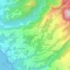
Plage de Rocroy topographic map

Click on the map to display elevation.

About this map

Name: Plage de Rocroy topographic map, elevation, terrain.

Location: Plage de Rocroy, Vieux-Habitants, Basse-Terre, Guadeloupe, 97119, France (16.04630 -61.76137 16.04699 -61.76091)

Average elevation: 34 m

Minimum elevation: 0 m

Maximum elevation: 186 m

Other topographic maps

Click on a map to view its topography, its elevation and its terrain.

Géry

France > Guadeloupe > Vieux-Habitants > Marigot

Average elevation: 137 m

Montrepos

France > Guadeloupe > Vieux-Habitants

Average elevation: 301 m

Le Tuf

France > Guadeloupe > Vieux-Habitants

Average elevation: 246 m

Beausoleil

France > Guadeloupe > Vieux-Habitants

Average elevation: 72 m

Grand Rivière

France > Guadeloupe > Vieux-Habitants

Average elevation: 231 m

Cousinière

France > Guadeloupe > Vieux-Habitants

Average elevation: 141 m

Beaugendre

France > Guadeloupe > Vieux-Habitants > Marigot

Average elevation: 197 m

Cousinière

France > Guadeloupe > Vieux-Habitants

Average elevation: 141 m

Gear up for your next adventure:

🚲MTB Frame Bag - Carry tools and maps directly on your bicycle frame
🎒Hiking Daypack - Lightweight and durable backpacks for day trips and excursions
🥾Lightweight Hiking Boots - Boots for comfort and mobility on long hikes
🍽️Titanium Camping Spork - Ultralight and indestructible eating utensil
🧭GPS Handheld Device - Reliable GPS navigation for outdoor adventures

As an Amazon Associate, this site earns from qualifying purchases at no extra cost to you.