Geolocate

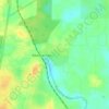
McIntosh topographic map

Click on the map to display elevation.

About this map

Name: McIntosh topographic map, elevation, terrain.

Location: McIntosh, Marion County, Florida, United States (29.44415 -82.23071 29.45500 -82.21148)

Average elevation: 33 m

Minimum elevation: 11 m

Maximum elevation: 58 m

Other topographic maps

Click on a map to view its topography, its elevation and its terrain.

Ocala

United States > Florida > Marion County > Ocala

Average elevation: 27 m

Monroes Corner

United States > Florida > Marion County

Average elevation: 25 m

Juniper Springs

United States > Florida > Marion County

Average elevation: 17 m

Orange Lake

United States > Florida > Marion County

Average elevation: 32 m

Gear up for your next adventure:

🧴Sunscreen SPF - Broad-spectrum sunscreen for outdoor activities
🥾Hiking Shorts - Breathable shorts suitable for summer hikes
🧥Softshell Jacket - Windproof and breathable jacket for hiking
🧥Fleece Jacket - Warm and lightweight jacket for layering
🥘Camping Cookware Set - Compact nesting pots and pans for trail cooking

As an Amazon Associate, this site earns from qualifying purchases at no extra cost to you.