Geolocate

Lloydminster topographic map

Click on the map to display elevation.

About this map

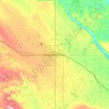
Name: Lloydminster topographic map, elevation, terrain.

Location: Lloydminster, Alberta, T9V 0C6, Canada (53.12000 -110.16885 53.44000 -109.84885)

Average elevation: 641 m

Minimum elevation: 563 m

Maximum elevation: 770 m

Alberta trails, hiking, mountain biking, running and outdoor activities

Gear up for your next adventure:

🥾Lightweight Hiking Shoes - Comfortable shoes for day hikes
🥾Waterproof Hiking Boots - Boots keeping your feet dry in wet conditions
👟Leg Gaiters - Keep debris, mud, and snow out of your boots
🥾Hiking Gaiters - Protect legs and shoes from mud, snow, and debris
🚲Handlebar Phone Mount - View topographic-map.com live while cycling

As an Amazon Associate, this site earns from qualifying purchases at no extra cost to you.