
сельское поселение Хужиры topographic map
Interactive map
Click on the map to display elevation.
About this map
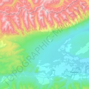
Name: сельское поселение Хужиры topographic map, elevation, terrain.
Average elevation: 1,411 m
Minimum elevation: 735 m
Maximum elevation: 3,241 m
Other topographic maps
Click on a map to view its topography, its elevation and its terrain.
Хурай-Хобок
Russia > Buryatia > Tunkinsky District > Huray-Hobok
Хурай-Хобок, Huray-Hobok, сельское поселение Толтой, Tunkinsky District, Buryatia, Far Eastern Federal District, Russia
Average elevation: 1,069 m