Geolocate

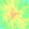
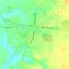
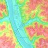
Laurel topographic map

Click on the map to display elevation.

About this map
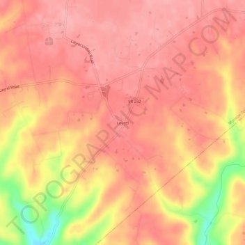
Name: Laurel topographic map, elevation, terrain.

Location: Laurel, Monroe Township, Clermont County, Ohio, 45153, United States (38.89534 -84.21160 38.93534 -84.17160)

Average elevation: 252 m

Minimum elevation: 170 m

Maximum elevation: 279 m

Other topographic maps

Click on a map to view its topography, its elevation and its terrain.
Batavia

United States > Ohio > Clermont County

Average elevation: 235 m

Felicity

United States > Ohio > Clermont County

Average elevation: 272 m

Moscow

United States > Ohio > Clermont County

Average elevation: 177 m

Goshen Township

United States > Ohio > Clermont County

Average elevation: 261 m

Batavia Township

United States > Ohio > Clermont County

Average elevation: 248 m

Milford

United States > Ohio > Clermont County

Average elevation: 187 m

Union Township

United States > Ohio > Clermont County

Average elevation: 234 m

Bethel

United States > Ohio > Clermont County

Average elevation: 271 m

Tate Township

United States > Ohio > Clermont County

Average elevation: 270 m

Amelia

United States > Ohio > Clermont County

Average elevation: 263 m

Jackson Township

United States > Ohio > Clermont County

Average elevation: 276 m

Pierce Township

United States > Ohio > Clermont County

Average elevation: 237 m

New Richmond

United States > Ohio > Clermont County

Average elevation: 200 m

Milford

United States > Ohio > Clermont County

Average elevation: 187 m

New Richmond

United States > Ohio > Clermont County

Average elevation: 200 m

New Richmond

United States > Ohio > Clermont County

Average elevation: 200 m

Goshen Township

United States > Ohio > Clermont County

Average elevation: 261 m

Amelia

United States > Ohio > Clermont County > Amelia

Average elevation: 265 m

Bethel

United States > Ohio > Clermont County

Average elevation: 271 m

Owensville

United States > Ohio > Clermont County

Average elevation: 264 m

Amelia

United States > Ohio > Clermont County

Average elevation: 263 m

Miami Township

United States > Ohio > Clermont County

Average elevation: 230 m

Gear up for your next adventure:

🥾Durable Hiking Shoes - Long-lasting shoes for frequent hiking
🧶550 Survival Paracord - Versatile utility cord for emergency repairs and rigging
☕Camping Coffee Maker - Brew fresh coffee anywhere on the topographic map
🧭GPS Handheld Device - Reliable GPS navigation for outdoor adventures
💡Compact LED Flashlight - Powerful and portable flashlight for outdoor use

As an Amazon Associate, this site earns from qualifying purchases at no extra cost to you.