
Jasper County topographic map
Interactive map
Click on the map to display elevation.
About this map
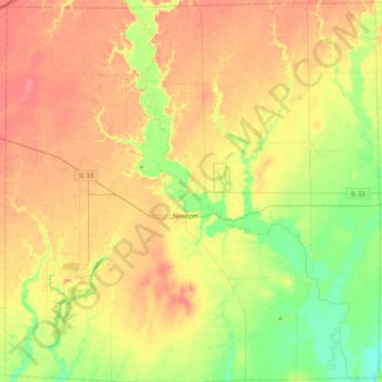
Name: Jasper County topographic map, elevation, terrain.
Location: Jasper County, Illinois, VS (38.84666 -88.36263 39.17659 -87.94475)
Average elevation: 162 m
Minimum elevation: 132 m
Maximum elevation: 190 m
Other topographic maps
Click on a map to view its topography, its elevation and its terrain.
Mount Vernon
VS > Illinois > Mount Vernon
Mount Vernon, Jefferson County, Illinois, VS
Average elevation: 147 m
Carpentersville
VS > Illinois > Carpentersville
Carpentersville, Kane County, Illinois, VS
Average elevation: 253 m