Geolocate

Medraz topographic map

Click on the map to display elevation.

About this map

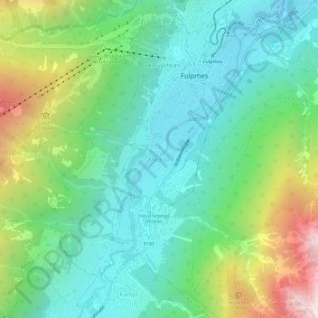
Name: Medraz topographic map, elevation, terrain.

Location: Medraz, Fulpmes, Bezirk Innsbruck-Land, Tyrol, 6166, Austria (47.12253 11.32253 47.16253 11.36253)

Average elevation: 1,277 m

Minimum elevation: 872 m

Maximum elevation: 2,263 m

Gear up for your next adventure:

🧥Thermal Layer - Insulating layer for cold outdoor conditions
🧰Multitool Knife - Compact and versatile tool for outdoor use
💧Hydration Pack - Hands-free hydration system for long hikes
🧴Waterproofing Spray - Restore the DWR coating on jackets and tents
🔥Camping Stove - Portable stoves to cook outdoors with ease

As an Amazon Associate, this site earns from qualifying purchases at no extra cost to you.