Geolocate

Tualatin topographic map

Click on the map to display elevation.

About this map
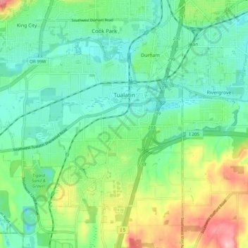
Name: Tualatin topographic map, elevation, terrain.

Location: Tualatin, Washington County, Oregon, 97062, United States (45.34703 -122.81784 45.40262 -122.72191)

Average elevation: 70 m

Minimum elevation: 23 m

Maximum elevation: 181 m

Gear up for your next adventure:

🧰Survival Kit - Essential gear for emergencies in the wilderness
🧥Softshell Jacket - Windproof and breathable jacket for hiking
🧼Travel Hand Sanitizer - Keep hands clean when water is scarce
🔦LED Headlamp - Hands-free lighting for early morning starts or late finishes
🥾Durable Hiking Shoes - Long-lasting shoes for frequent hiking

As an Amazon Associate, this site earns from qualifying purchases at no extra cost to you.