Geolocate

Viento topographic map

Click on the map to display elevation.

About this map

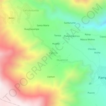
Name: Viento topographic map, elevation, terrain.

Location: Viento, Pampacolca, Province of Castilla, Arequipa, Peru (-15.72528 -72.61501 -15.68528 -72.57501)

Average elevation: 3,290 m

Minimum elevation: 2,774 m

Maximum elevation: 3,997 m

Gear up for your next adventure:

🧰Survival Kit - Essential gear for emergencies in the wilderness
🥾Mountain Trail Shoes - High-traction shoes for mountain trails
🔋Lithium AA Batteries - Long-lasting power that performs in extreme cold
🧤Rechargeable Heated Gloves - Extreme warmth for Canadian winter expeditions
🦯Trekking Poles - Reduced impact on joints for steep topographic climbs

As an Amazon Associate, this site earns from qualifying purchases at no extra cost to you.