Geolocate

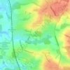
North Mymms topographic map

Click on the map to display elevation.

About this map

Name: North Mymms topographic map, elevation, terrain.

Location: North Mymms, Brookmans Park, Welwyn Hatfield, Hertfordshire, England, United Kingdom (51.70257 -0.25516 51.74563 -0.15667)

Average elevation: 102 m

Minimum elevation: 72 m

Maximum elevation: 133 m

Other topographic maps

Click on a map to view its topography, its elevation and its terrain.
Gear up for your next adventure:

🥾Light Trekking Boots - Supportive boots for multi-day treks
🧥Thermal Fleece Jacket - Versatile insulation for changing mountain temperatures
🧦Merino Wool Socks - Moisture-wicking comfort for long-distance hiking
🧴Bear Spray Holster - Quick-access carry for essential Canadian wilderness safety
🧥Packable Rain Jacket - Breathable waterproof layer for unpredictable weather

As an Amazon Associate, this site earns from qualifying purchases at no extra cost to you.