Geolocate

Kyllburg topographic map

Click on the map to display elevation.

About this map
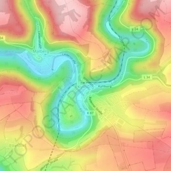
Name: Kyllburg topographic map, elevation, terrain.

Location: Kyllburg, Bitburger Land, Eifelkreis Bitburg-Prüm, Rijnland-Palts, 54657, Duitsland (50.02664 6.58018 50.05597 6.61793)

Average elevation: 372 m

Minimum elevation: 257 m

Maximum elevation: 469 m

Other topographic maps

Click on a map to view its topography, its elevation and its terrain.

Gear up for your next adventure:

💡LED Camping Lantern - Illuminate your campsite with long-lasting lanterns
🌬️Windproof Camp Stove - Efficient cooking even on exposed mountain peaks
🧣Evaporative Cooling Towel - Beat the heat during intense summer climbs
🧢Hiking Sun Hat - Wide-brimmed protection for exposed mountain ridges
🧢Outdoor Cap - Protective cap for sun and rain during hikes

As an Amazon Associate, this site earns from qualifying purchases at no extra cost to you.