Geolocate

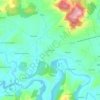
Lugo topographic map

Click on the map to display elevation.

About this map

Name: Lugo topographic map, elevation, terrain.

Location: Lugo, Llanera, Asturias, España (43.41193 -5.84869 43.46361 -5.78965)

Average elevation: 187 m

Minimum elevation: 103 m

Maximum elevation: 429 m

Other topographic maps

Click on a map to view its topography, its elevation and its terrain.

Guyame

España > Asturias > Llanera

Average elevation: 175 m

Soto de Llanera

España > Asturias > Llanera

Average elevation: 203 m

Posada de Llanera

España > Asturias > Llanera

Average elevation: 207 m

Verdera

España > Asturias > Llanera

Average elevation: 271 m

San Cucao

España > Asturias > Llanera

Average elevation: 175 m

Gear up for your next adventure:

🧴Bear Spray Holster - Quick-access carry for essential Canadian wilderness safety
🌬️Windproof Camp Stove - Efficient cooking even on exposed mountain peaks
⛺Camping Groundsheet - Protect your tent from moisture and dirt
🎒Hiking Backpack - Lightweight and ergonomic backpacks for day hikes or multi-day treks
🧼Travel Hand Sanitizer - Keep hands clean when water is scarce

As an Amazon Associate, this site earns from qualifying purchases at no extra cost to you.