Geolocate

Verdera topographic map

Click on the map to display elevation.

About this map

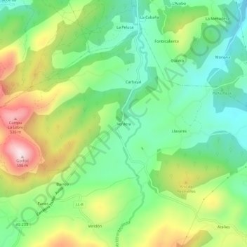
Name: Verdera topographic map, elevation, terrain.

Location: Verdera, Llanera, Asturias, 33406, España (43.46630 -5.92866 43.50630 -5.88866)

Average elevation: 271 m

Minimum elevation: 101 m

Maximum elevation: 561 m

Gear up for your next adventure:

🧭GPS Outdoor Watch - Smart watch for navigation and fitness tracking in nature
🧴Bear Spray Holster - Quick-access carry for essential Canadian wilderness safety
🧣Evaporative Cooling Towel - Beat the heat during intense summer climbs
🥾Mountain Hiking Shoes - Shoes with superior grip for mountainous terrain
🏕️Camping Hammock - Integrated protection for sleeping between trees

As an Amazon Associate, this site earns from qualifying purchases at no extra cost to you.