Geolocate

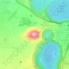
St. Luis topographic map

Click on the map to display elevation.

About this map

Name: St. Luis topographic map, elevation, terrain.

Location: St. Luis, Villa El Carmen, Managua, 16500, Nicaragua (11.88649 -86.58447 11.89051 -86.58138)

Average elevation: 14 m

Minimum elevation: 0 m

Maximum elevation: 61 m

Other topographic maps

Click on a map to view its topography, its elevation and its terrain.
Laguna de Tiscapa

Nicaragua > Managua > Managua

Average elevation: 90 m

Cerro Motastepe

Nicaragua > Managua > Ciudad Sandino

Average elevation: 155 m

El Salto

Nicaragua > Managua

Average elevation: 187 m

Masachapa

Nicaragua > Managua > Masachapa

Average elevation: 7 m

Gear up for your next adventure:

🥾Mountain Trail Shoes - High-traction shoes for mountain trails
🧢Sun Protection Cap - Breathable cap to protect from sun exposure
🧥Fleece Jacket - Warm and lightweight jacket for layering
🥾Waterproof Hiking Boots - Essential footwear for rugged terrain and wet Canadian trails
🦯Trekking Poles - Reduced impact on joints for steep topographic climbs

As an Amazon Associate, this site earns from qualifying purchases at no extra cost to you.