Geolocate

Masachapa topographic map

Click on the map to display elevation.

About this map

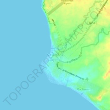
Name: Masachapa topographic map, elevation, terrain.

Location: Masachapa, Managua, 16700, Nicaragua (11.76467 -86.53594 11.80467 -86.49594)

Average elevation: 7 m

Minimum elevation: -1 m

Maximum elevation: 28 m

Gear up for your next adventure:

💧Collapsible Water Bottle - Space-saving water bottle for outdoor activities
🛶Canoe Life Vest - Safety vest for water sports
🥾Hiking Boots - Sturdy boots providing ankle support and traction on rugged trails
🥾Trail Hiking Boots - Supportive boots for rough trails
🥘Camping Cookware Set - Compact nesting pots and pans for trail cooking

As an Amazon Associate, this site earns from qualifying purchases at no extra cost to you.