Geolocate

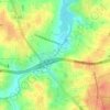
Starmount Forest topographic map

Click on the map to display elevation.

About this map

Name: Starmount Forest topographic map, elevation, terrain.

Location: Starmount Forest, Greensboro, Guilford County, North Carolina, 27408, United States (36.05958 -79.86420 36.09958 -79.82420)

Average elevation: 259 m

Minimum elevation: 231 m

Maximum elevation: 292 m

Other topographic maps

Click on a map to view its topography, its elevation and its terrain.
Gear up for your next adventure:

🚲Heavy Duty Bike Lock - Secure your bike at the trailhead or during stops
⛺Lightweight Camping Tent - Portable shelter optimized for Canadian backcountry camping
🦟Insect Repellent - Keep mosquitoes and black flies away in wooded areas
🎒Hiking Daypack - Lightweight and durable backpacks for day trips and excursions
🧊Portable Cooler - Keep food and drinks cold during outdoor adventures

As an Amazon Associate, this site earns from qualifying purchases at no extra cost to you.