
Horsepen Creek topographic map
Interactive map
Click on the map to display elevation.
About this map
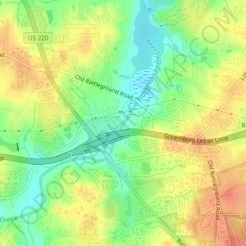
Name: Horsepen Creek topographic map, elevation, terrain.
Average elevation: 249 m
Minimum elevation: 223 m
Maximum elevation: 272 m
Other topographic maps
Click on a map to view its topography, its elevation and its terrain.
Hilltop
United States > North Carolina > Guilford County > Greensboro
Hilltop, Greensboro, Guilford County, North Carolina, 27407, United States
Average elevation: 262 m
Madison Woods
United States > North Carolina > Guilford County > Greensboro
Madison Woods, Greensboro, Guilford County, North Carolina, 24707, United States
Average elevation: 275 m
Greensboro
United States > North Carolina > Guilford County > Greensboro
Greensboro, Guilford County, North Carolina, 27402, United States
Average elevation: 241 m