Geolocate

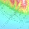
Rakovski topographic map

Click on the map to display elevation.

About this map

Name: Rakovski topographic map, elevation, terrain.

Location: Rakovski, Plovdiv, 4150, Bulgaria (42.23186 24.88024 42.34068 25.05499)

Average elevation: 188 m

Minimum elevation: 151 m

Maximum elevation: 255 m

Other topographic maps

Click on a map to view its topography, its elevation and its terrain.
Hrabrino

Bulgaria > Plovdiv

Average elevation: 466 m

Botev Peak

Bulgaria > Plovdiv

Average elevation: 2,040 m

Sopot

Bulgaria > Plovdiv

Average elevation: 670 m

Stamboliyski

Bulgaria > Plovdiv

Average elevation: 187 m

Gear up for your next adventure:

🥾Light Hiking Boots - Lightweight and comfortable boots for day hikes
🧥Insulated Jacket - Keep warm in cold outdoor conditions
🥾Trail Running Shoes - Lightweight and durable shoes for trail running
🧥Softshell Hiking Jacket - The perfect balance of wind protection and breathability
🔨Vehicle Emergency Tool - Safety tool for remote road trips to trailheads

As an Amazon Associate, this site earns from qualifying purchases at no extra cost to you.