Geolocate

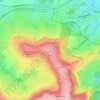
Egypt Point topographic map

Click on the map to display elevation.

About this map

Name: Egypt Point topographic map, elevation, terrain.

Location: Egypt Point, Lower Hyde, Shanklin, Isle of Wight, England, United Kingdom (50.63340 -1.18568 50.63388 -1.18485)

Average elevation: 45 m

Minimum elevation: 0 m

Maximum elevation: 195 m

Other topographic maps

Click on a map to view its topography, its elevation and its terrain.
Luccombe

United Kingdom > England > Isle of Wight > Shanklin

Average elevation: 62 m

Shanklin Down

United Kingdom > England > Isle of Wight > Shanklin

Average elevation: 126 m

Luccombe

United Kingdom > England > Isle of Wight > Shanklin

Average elevation: 62 m

Gear up for your next adventure:

🕶️Polarized Sunglasses - Reduces glare from snow and water at high elevations
🧴First Aid Kit - Essential first aid supplies for outdoor emergencies
🦌Outdoor Trail Camera - Monitor wildlife activity near your favorite spots
🥾Trail Hiking Shoes - Durable shoes designed for rugged trails
⛺Camping Groundsheet - Protect your tent from moisture and dirt

As an Amazon Associate, this site earns from qualifying purchases at no extra cost to you.