
Aldersyde topographic map
Interactive map
Click on the map to display elevation.
About this map
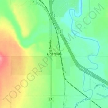
Name: Aldersyde topographic map, elevation, terrain.
Location: Aldersyde, Foothills County, Alberta, T0L 1T0, Canada (50.65493 -113.90019 50.69493 -113.86019)
Average elevation: 1,046 m
Minimum elevation: 1,014 m
Maximum elevation: 1,103 m
Foothills County trails, hiking, mountain biking, running and outdoor activities
Other topographic maps
Click on a map to view its topography, its elevation and its terrain.