
Belvidere Township topographic map
Interactive map
Click on the map to display elevation.
About this map
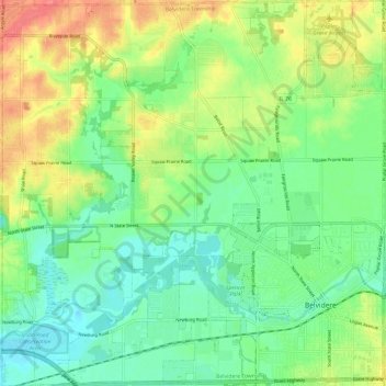
Name: Belvidere Township topographic map, elevation, terrain.
Location: Belvidere Township, Boone County, Illinois, United States (42.23940 -88.94059 42.32792 -88.82178)
Average elevation: 245 m
Minimum elevation: 220 m
Maximum elevation: 286 m
Other topographic maps
Click on a map to view its topography, its elevation and its terrain.
Leroy Township
United States > Illinois > Boone County
Leroy Township, Boone County, Illinois, United States
Average elevation: 292 m
Poplar Grove
United States > Illinois > Boone County
Poplar Grove, Poplar Grove Township, Boone County, Illinois, 61065, United States
Average elevation: 263 m