
Leroy Township topographic map
Interactive map
Click on the map to display elevation.
About this map
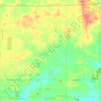
Name: Leroy Township topographic map, elevation, terrain.
Location: Leroy Township, Boone County, Illinois, United States (42.41486 -88.82169 42.49364 -88.70595)
Average elevation: 292 m
Minimum elevation: 266 m
Maximum elevation: 320 m
Other topographic maps
Click on a map to view its topography, its elevation and its terrain.