
Trenton topographic map
Interactive map
Click on the map to display elevation.
About this map
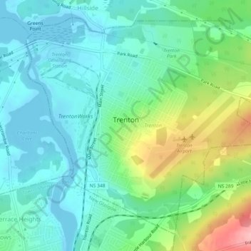
Name: Trenton topographic map, elevation, terrain.
Location: Trenton, Pictou County, Nova Scotia, Canada (45.59953 -62.65118 45.62696 -62.60580)
Average elevation: 37 m
Minimum elevation: -1 m
Maximum elevation: 136 m