Geolocate

Oakham topographic map

Click on the map to display elevation.

About this map
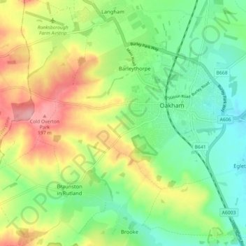
Name: Oakham topographic map, elevation, terrain.

Location: Oakham, Rutland, England, United Kingdom (52.65010 -0.79453 52.68328 -0.70559)

Average elevation: 132 m

Minimum elevation: 85 m

Maximum elevation: 204 m

Other topographic maps

Click on a map to view its topography, its elevation and its terrain.
Oakham Canal

United Kingdom > England > Rutland > Oakham

Average elevation: 115 m

Gear up for your next adventure:

💧Collapsible Water Bottle - Space-saving water bottle for outdoor activities
🥾Hiking Shorts - Breathable shorts suitable for summer hikes
🔦LED Headtorch - Bright and durable light for night activities
🪑Insulated Seat Pad - Protect your seat from cold rocks and wet logs
📷Outdoor Action Camera - Capture high-elevation views and rugged adventures

As an Amazon Associate, this site earns from qualifying purchases at no extra cost to you.