Geolocate

Hathern topographic map

Click on the map to display elevation.

About this map

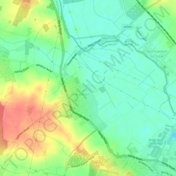
Name: Hathern topographic map, elevation, terrain.

Location: Hathern, Charnwood, Leicestershire, England, United Kingdom (52.78463 -1.27965 52.81043 -1.22790)

Average elevation: 48 m

Minimum elevation: 26 m

Maximum elevation: 83 m

Gear up for your next adventure:

🥾Hiking Leggings - Comfortable leggings for outdoor activities
🌬️Windproof Camp Stove - Efficient cooking even on exposed mountain peaks
🥾Trekking Boots - Durable boots for long-distance trekking
Family Camping Tent - Spacious tent suitable for family camping trips
🥾Durable Hiking Shoes - Long-lasting shoes for frequent hiking

As an Amazon Associate, this site earns from qualifying purchases at no extra cost to you.