Geolocate

Cleburne topographic map

Click on the map to display elevation.

About this map

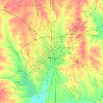
Name: Cleburne topographic map, elevation, terrain.

Location: Cleburne, Johnson County, Texas, United States (32.27795 -97.54567 32.43725 -97.34621)

Average elevation: 250 m

Minimum elevation: 207 m

Maximum elevation: 291 m

Other topographic maps

Click on a map to view its topography, its elevation and its terrain.

Grandview

United States > Texas > Johnson County

Average elevation: 206 m

Gear up for your next adventure:

🧥Softshell Jacket - Windproof and breathable jacket for hiking
🕯️Camping Lantern - Illuminates your entire campsite with high-efficiency LEDs
🧣Evaporative Cooling Towel - Beat the heat during intense summer climbs
🧦Thermal Socks - Warm socks for winter hiking or camping
📷Outdoor Action Camera - Capture high-elevation views and rugged adventures

As an Amazon Associate, this site earns from qualifying purchases at no extra cost to you.