
Grandview topographic map
Click on the map to display elevation.
About this map
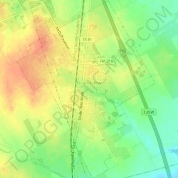
Name: Grandview topographic map, elevation, terrain.
Location: Grandview, Johnson County, Texas, United States (32.24836 -97.19497 32.28237 -97.16370)
Average elevation: 206 m
Minimum elevation: 182 m
Maximum elevation: 226 m
Other topographic maps
Click on a map to view its topography, its elevation and its terrain.