Geolocate

El Cardon topographic map

Click on the map to display elevation.

About this map

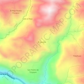
Name: El Cardon topographic map, elevation, terrain.

Location: El Cardon, Cutervo, Province of Cutervo, Cajamarca, Peru (-6.50183 -78.82617 -6.46183 -78.78617)

Average elevation: 2,316 m

Minimum elevation: 1,839 m

Maximum elevation: 2,691 m

Gear up for your next adventure:

🥾Mountaineering Boots - Supportive boots for climbing and high-altitude hiking
🔨Vehicle Emergency Tool - Safety tool for remote road trips to trailheads
🕶️Polarized Sunglasses - Reduces glare from snow and water at high elevations
🥾Lightweight Hiking Shoes - Comfortable shoes for day hikes
🧥Waterproof Hiking Jacket - Protect yourself from rain and wind while hiking

As an Amazon Associate, this site earns from qualifying purchases at no extra cost to you.