Geolocate

Utscheid topographic map

Click on the map to display elevation.

About this map
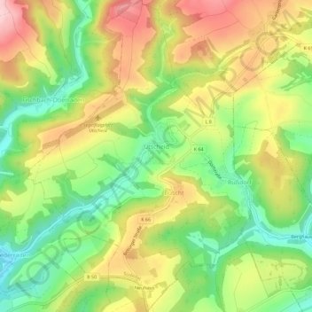
Name: Utscheid topographic map, elevation, terrain.

Location: Utscheid, Südeifel, Eifelkreis Bitburg-Prüm, Rijnland-Palts, Duitsland (49.97550 6.33092 50.01175 6.37156)

Average elevation: 384 m

Minimum elevation: 285 m

Maximum elevation: 496 m

Other topographic maps

Click on a map to view its topography, its elevation and its terrain.

Gear up for your next adventure:

🧦Hiking Liner Socks - Thin base layer to prevent friction and blisters
🥽Outdoor Goggles - Protective eyewear for outdoor activities
📷Outdoor Action Camera - Capture high-elevation views and rugged adventures
⛺Camping Essentials - All-in-one gear for a comfortable camping trip
🔪Outdoor Multitool - Versatile tool for repairs and food prep in the wild

As an Amazon Associate, this site earns from qualifying purchases at no extra cost to you.