
Cattal topographic map
Click on the map to display elevation.
About this map
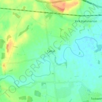
Name: Cattal topographic map, elevation, terrain.
Average elevation: 25 m
Minimum elevation: 12 m
Maximum elevation: 52 m
Other topographic maps
Click on a map to view its topography, its elevation and its terrain.
Dent Crag Ridge
United Kingdom > England > North Yorkshire > Harrogate > Dacre
Average elevation: 301 m
Marston Moor
United Kingdom > England > North Yorkshire > Harrogate > Long Marston
Average elevation: 24 m
Kirkby Malzeard
United Kingdom > England > North Yorkshire > Harrogate > Kirkby Malzeard
Average elevation: 152 m