Geolocate

Bukit Tampoi topographic map

Click on the map to display elevation.

About this map

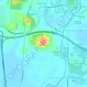
Name: Bukit Tampoi topographic map, elevation, terrain.

Location: Bukit Tampoi, Sepang, Selangor, 43800, Malaysia (2.84641 101.67230 2.84651 101.67240)

Average elevation: 14 m

Minimum elevation: 2 m

Maximum elevation: 80 m

Other topographic maps

Click on a map to view its topography, its elevation and its terrain.

Sungai Sepang

Malaysia > Selangor > Sepang

Average elevation: 8 m

Cyberjaya

Malaysia > Selangor > Sepang

Average elevation: 24 m

Bagan Lalang Beach

Malaysia > Selangor > Sepang > Bagan Lalang

Average elevation: 2 m

Cyberjaya Lake Park

Malaysia > Selangor > Sepang > Cyberjaya

Average elevation: 18 m

Sungai Jenderam

Malaysia > Selangor > Sepang > Jenderam

Average elevation: 46 m

Obama Oval

Malaysia > Selangor > Sepang > Cyberjaya

Average elevation: 30 m

Cyberjaya

Malaysia > Selangor > Sepang

Average elevation: 24 m

Sungai Labu

Malaysia > Selangor > Sepang

Average elevation: 19 m

Cyberjaya

Malaysia > Selangor > Sepang

Average elevation: 24 m

Putra Prima Playground

Malaysia > Selangor > Sepang

Average elevation: 7 m

Sungai Salak

Malaysia > Selangor > Sepang

Average elevation: 26 m

Gear up for your next adventure:

🥾Lightweight Hiking Boots - Boots for comfort and mobility on long hikes
🧢Outdoor Cap - Protective cap for sun and rain during hikes
Lightweight Backpacking Tent - Compact tent for efficient hiking trips
🥾Waterproof Hiking Boots - Boots keeping your feet dry in wet conditions
🧣Merino Neck Gaiter - Protects against wind, sun, and cold at high altitudes

As an Amazon Associate, this site earns from qualifying purchases at no extra cost to you.