
Modoc topographic map
Click on the map to display elevation.
About this map
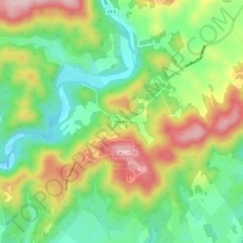
Name: Modoc topographic map, elevation, terrain.
Location: Modoc, Greenbrier County, West Virginia, United States (38.00429 -80.36508 38.04429 -80.32508)
Average elevation: 701 m
Minimum elevation: 592 m
Maximum elevation: 852 m
Other topographic maps
Click on a map to view its topography, its elevation and its terrain.
Alderson Recreation Area
United States > West Virginia > Greenbrier County > Alderson
Average elevation: 501 m