
Make a donation
Gear up for your next adventure:
As an Amazon Associate, this site earns from qualifying purchases at no extra cost to you.
Pilion topographic map
Click on the map to display elevation.
Make a donation
Gear up for your next adventure:
As an Amazon Associate, this site earns from qualifying purchases at no extra cost to you.
About this map
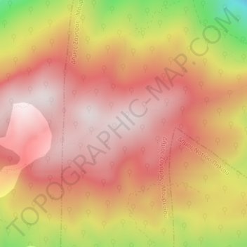
Name: Pilion topographic map, elevation, terrain.
Average elevation: 1,239 m
Minimum elevation: 816 m
Maximum elevation: 1,449 m
Make a donation
Gear up for your next adventure:
As an Amazon Associate, this site earns from qualifying purchases at no extra cost to you.
Other topographic maps
Click on a map to view its topography, its elevation and its terrain.
Volos Municipality
Greece > Thessaly and Central Greece > Regional Unit of Magnesia
Average elevation: 228 m
Lake Karla
Greece > Thessaly and Central Greece > Regional Unit of Magnesia > Municipal Unit of Karla
After draining, site included Mavrovouni Mountain, two water reservoirs in former Lake Karla and the spring Kefalovryso in Velestino. Mavrovouni (390 km2 or 96,000 acres, max elevation 1,054 m or 3,458 ft) extends between Ossa and Pilio mountains and was restored totally in Magnesia. It mainly consists of…
Average elevation: 103 m
Municipal Unit of Karla
Greece > Thessaly and Central Greece > Regional Unit of Magnesia
Average elevation: 212 m
Make a donation
Gear up for your next adventure:
As an Amazon Associate, this site earns from qualifying purchases at no extra cost to you.