Geolocate

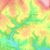
Fletchersbridge topographic map

Click on the map to display elevation.

About this map

Name: Fletchersbridge topographic map, elevation, terrain.

Location: Fletchersbridge, Bodmin, Cornwall, England, PL30 4AT, United Kingdom (50.44220 -4.69527 50.48220 -4.65527)

Average elevation: 115 m

Minimum elevation: 17 m

Maximum elevation: 184 m

Other topographic maps

Click on a map to view its topography, its elevation and its terrain.
Cardinham Woods

United Kingdom > England > Cornwall > Bodmin

Average elevation: 143 m

Gear up for your next adventure:

🧦Outdoor Socks - Durable socks designed for hiking and outdoor sports
🧊Insulated Water Bottle - Keeps drinks cold in summer and prevents freezing in winter
🛶Kayak Dry Bag - Waterproof storage for kayaking adventures
🦶Anti-Blister Balm - Prevents friction and hotspots during long ascents
🧤Thermal Hiking Gloves - Grip-enhanced gloves for cold-weather altitude trekking

As an Amazon Associate, this site earns from qualifying purchases at no extra cost to you.