Geolocate

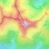
Berwang topographic map

Click on the map to display elevation.

About this map

Name: Berwang topographic map, elevation, terrain.

Location: Berwang, Bezirk Reutte, Tyrol, 6622, Austria (47.35604 10.68800 47.42655 10.81907)

Average elevation: 1,609 m

Minimum elevation: 1,017 m

Maximum elevation: 2,442 m

Other topographic maps

Click on a map to view its topography, its elevation and its terrain.

Schmitte

Austria > Tyrol > Bezirk Reutte > Biberwier

Average elevation: 1,203 m

Hochvogel

Austria > Tyrol > Bezirk Reutte > Hinterhornbach

Average elevation: 1,897 m

Tannheim Mountains

Austria > Tyrol > Bezirk Reutte > Musau

Average elevation: 1,646 m

Lähn

Austria > Tyrol > Bezirk Reutte

Average elevation: 1,049 m

Aggenstein

Austria > Tyrol > Bezirk Reutte

Average elevation: 1,478 m

Gear up for your next adventure:

🛶Canoe Life Vest - Safety vest for water sports
🥾Mountain Trail Shoes - High-traction shoes for mountain trails
🥾Hiking Shorts - Breathable shorts suitable for summer hikes
🥾Lightweight Hiking Boots - Boots for comfort and mobility on long hikes
🧭GPS Outdoor Watch - Smart watch for navigation and fitness tracking in nature

As an Amazon Associate, this site earns from qualifying purchases at no extra cost to you.