Geolocate

Wisbech St. Mary topographic map

Click on the map to display elevation.

About this map
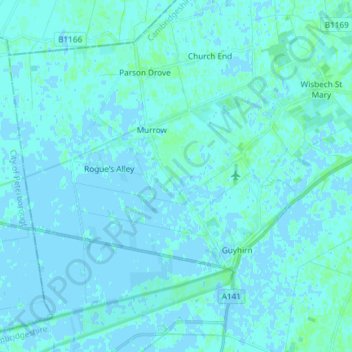
Name: Wisbech St. Mary topographic map, elevation, terrain.

Location: Wisbech St. Mary, Fenland District, Cambridgeshire, Cambridgeshire and Peterborough, England, United Kingdom (52.59427 -0.02446 52.66674 0.12358)

Average elevation: 1 m

Minimum elevation: -3 m

Maximum elevation: 6 m

Other topographic maps

Click on a map to view its topography, its elevation and its terrain.
Gear up for your next adventure:

🕶️Polarized Sunglasses - Protect your eyes with durable polarized lenses
🩹Compact First Aid Kit - Pre-packed essentials for common trail injuries
📷Outdoor Action Camera - Capture high-elevation views and rugged adventures
🧴First Aid Kit - Essential first aid supplies for outdoor emergencies
🛰️Satellite Messenger - Emergency communication for areas with no cell service

As an Amazon Associate, this site earns from qualifying purchases at no extra cost to you.