Geolocate

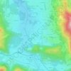
Tegernsee topographic map

Click on the map to display elevation.

About this map
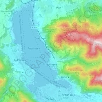
Name: Tegernsee topographic map, elevation, terrain.

Location: Tegernsee, Landkreis Miesbach, Bavaria, 83684, Germany (47.68892 11.71849 47.74774 11.81328)

Average elevation: 858 m

Minimum elevation: 722 m

Maximum elevation: 1,328 m

Other topographic maps

Click on a map to view its topography, its elevation and its terrain.
Gotzing

Germany > Bavaria > Landkreis Miesbach > Weyarn

Average elevation: 695 m

Sandbichl

Germany > Bavaria > Landkreis Miesbach > Marbach

Average elevation: 832 m

Buch

Germany > Bavaria > Landkreis Miesbach > Bad Wiessee

Average elevation: 904 m

Kalten

Germany > Bavaria > Landkreis Miesbach > Niklasreuth

Average elevation: 682 m

Floiger

Germany > Bavaria > Landkreis Miesbach > Miesbach

Average elevation: 769 m

Gear up for your next adventure:

🧦Hiking Liner Socks - Thin base layer to prevent friction and blisters
🧥Thermal Fleece Jacket - Versatile insulation for changing mountain temperatures
🧴Sunscreen SPF - Broad-spectrum sunscreen for outdoor activities
🧼Biodegradable Camp Soap - Environmentally friendly cleaning for gear and body
🥾Durable Hiking Shoes - Long-lasting shoes for frequent hiking

As an Amazon Associate, this site earns from qualifying purchases at no extra cost to you.