Geolocate

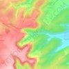
Fussy topographic map

Click on the map to display elevation.

About this map

Name: Fussy topographic map, elevation, terrain.

Location: Fussy, Bourges, Cher, Centre-Val de Loire, Metropolitan France, 18110, France (47.12358 2.40080 47.16368 2.45306)

Average elevation: 156 m

Minimum elevation: 131 m

Maximum elevation: 174 m

Other topographic maps

Click on a map to view its topography, its elevation and its terrain.

Les Houards

France > Centre-Val de Loire > Cher > Le Grouzeau

Average elevation: 157 m

Ivry

France > Centre-Val de Loire > Cher > Vasselay

Average elevation: 159 m

Chavignol

France > Centre-Val de Loire > Cher > Amigny

Average elevation: 282 m

La Garde de Dieu

France > Centre-Val de Loire > Cher > Culan

Average elevation: 276 m

Crux

France > Centre-Val de Loire > Cher > Villequiers

Average elevation: 196 m

Bertrix

France > Centre-Val de Loire > Cher > Clémont

Average elevation: 148 m

Gear up for your next adventure:

🥾Hiking Boots - Sturdy boots providing ankle support and traction on rugged trails
🦯Trekking Poles - Reduced impact on joints for steep topographic climbs
⛺Camping Groundsheet - Protect your tent from moisture and dirt
🌡️Emergency Mylar Blankets - Compact thermal protection for unexpected nights outdoors
🥾Mountaineering Boots - Supportive boots for climbing and high-altitude hiking

As an Amazon Associate, this site earns from qualifying purchases at no extra cost to you.