Geolocate

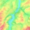
Culan topographic maps

Click on a map to view its topography, its elevation and its terrain.

La Garde de Dieu

France > Centre-Val de Loire > Cher > Culan

Average elevation: 276 m

Gear up for your next adventure:

🧦Outdoor Socks - Durable socks designed for hiking and outdoor sports
🗺️Topographic Maps - Detailed maps to explore trails, mountains, and wilderness areas
🛁Quick-Dry Microfiber Towel - Space-saving towel that dries rapidly on the move
🥾Trail Hiking Boots - Supportive boots for rough trails
🥾Hiking Boots - Sturdy boots providing ankle support and traction on rugged trails

As an Amazon Associate, this site earns from qualifying purchases at no extra cost to you.