Geolocate

Wordsley topographic map

Click on the map to display elevation.

About this map
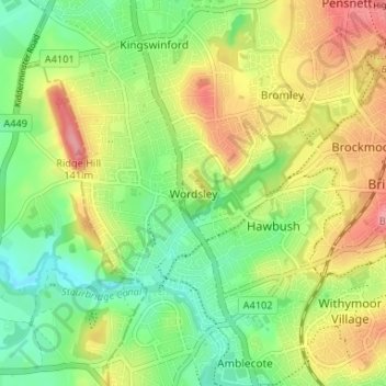
Name: Wordsley topographic map, elevation, terrain.

Location: Wordsley, Dudley, West Midlands, England, DY8 5RF, United Kingdom (52.46130 -2.17948 52.50130 -2.13948)

Average elevation: 98 m

Minimum elevation: 55 m

Maximum elevation: 153 m

Other topographic maps

Click on a map to view its topography, its elevation and its terrain.

Swan Lake

United Kingdom > England > Dudley > Amblecote

Average elevation: 102 m

Gear up for your next adventure:

🦌Outdoor Trail Camera - Monitor wildlife activity near your favorite spots
🥾Light Hiking Boots - Lightweight and comfortable boots for day hikes
🥾Hiking Shorts - Breathable shorts suitable for summer hikes
🧴Insect Repellent - Protect yourself from bugs during outdoor adventures
⛺Tent Footprint - Protect tent floor and increase durability

As an Amazon Associate, this site earns from qualifying purchases at no extra cost to you.