Geolocate

Capilano topographic map

Click on the map to display elevation.

About this map

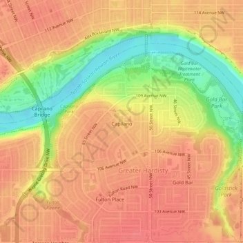
Name: Capilano topographic map, elevation, terrain.

Location: Capilano, Greater Hardisty, Edmonton, Alberta, Canada (53.54930 -113.43595 53.56011 -113.40968)

Average elevation: 650 m

Minimum elevation: 608 m

Maximum elevation: 670 m

Alberta trails, hiking, mountain biking, running and outdoor activities

Other topographic maps

Click on a map to view its topography, its elevation and its terrain.

William Hawrelak Park

Canada > Alberta > Edmonton

Average elevation: 649 m

Horseshoe Lake

Canada > Alberta > Edmonton

Average elevation: 680 m

landslide

Canada > Alberta > Edmonton

Average elevation: 668 m

Ormsby Park

Canada > Alberta > Edmonton

Average elevation: 688 m

Gear up for your next adventure:

🥾Hiking Shoes - Durable and comfortable shoes for trail hiking
🥾Hiking Gaiters - Protect legs and shoes from mud, snow, and debris
🥾Light Trekking Boots - Supportive boots for multi-day treks
🎒Backpack Rain Cover - External shield to keep your entire pack dry
🧴Outdoor Sunscreen - High SPF protection for high-altitude UV exposure

As an Amazon Associate, this site earns from qualifying purchases at no extra cost to you.