Geolocate

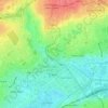
Guérinière topographic map

Click on the map to display elevation.

About this map

Name: Guérinière topographic map, elevation, terrain.

Location: Guérinière, Caen, Calvados, Normandie, France métropolitaine, 14000, France (49.15301 -0.34860 49.16495 -0.33738)

Average elevation: 28 m

Minimum elevation: 9 m

Maximum elevation: 40 m

Other topographic maps

Click on a map to view its topography, its elevation and its terrain.
Bas de Venoix

France > Normandie > Calvados > Caen

Average elevation: 23 m

Manoir des Gens d'Armes

France > Normandie > Calvados > Caen

Average elevation: 21 m

Vallée des Jardins

France > Normandie > Calvados > Caen

Average elevation: 48 m

Gear up for your next adventure:

🧭GPS Tracker - Track your location in remote areas safely
🥾All-Terrain Hiking Boots - Versatile boots for varied hiking conditions
🥤Collapsible Travel Cup - Saves space and weight in your mess kit
🦯Trekking Poles - Reduced impact on joints for steep topographic climbs
📷Outdoor Action Camera - Capture high-elevation views and rugged adventures

As an Amazon Associate, this site earns from qualifying purchases at no extra cost to you.