Geolocate

Hamden topographic map

Click on the map to display elevation.

About this map
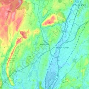
Name: Hamden topographic map, elevation, terrain.

Location: Hamden, New Haven County, Connecticut, United States (41.32720 -72.97529 41.46410 -72.85136)

Average elevation: 64 m

Minimum elevation: -3 m

Maximum elevation: 267 m

Gear up for your next adventure:

🪑Insulated Seat Pad - Protect your seat from cold rocks and wet logs
🧦Thermal Socks - Warm socks for winter hiking or camping
🔪Outdoor Multitool - Versatile tool for repairs and food prep in the wild
🧦Merino Wool Socks - Moisture-wicking comfort for long-distance hiking
👟Trail Running Shoes - Agile footwear for fast-paced topographic exploration

As an Amazon Associate, this site earns from qualifying purchases at no extra cost to you.