Geolocate

Strazha topographic map

Click on the map to display elevation.

About this map

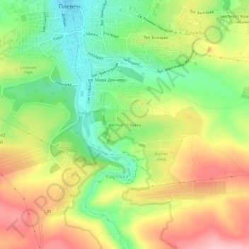
Name: Strazha topographic map, elevation, terrain.

Location: Strazha, Pleven, 5703, Bulgaria (43.36998 24.61028 43.40998 24.65028)

Average elevation: 181 m

Minimum elevation: 100 m

Maximum elevation: 274 m

Gear up for your next adventure:

🔦LED Headlamp - Hands-free lighting for early morning starts or late finishes
🧥Waterproof Jacket - Lightweight rain jackets for hiking and outdoor activities
🧳Compression Sacks - Maximize space in your backpack by shrinking gear
🔭Outdoor Binoculars - Lightweight binoculars for birdwatching and hiking
🧶550 Survival Paracord - Versatile utility cord for emergency repairs and rigging

As an Amazon Associate, this site earns from qualifying purchases at no extra cost to you.