
Sullivan County topographic map
Click on the map to display elevation.
About this map
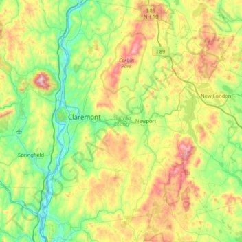
Name: Sullivan County topographic map, elevation, terrain.
Location: Sullivan County, New Hampshire, United States (43.12880 -72.45294 43.60027 -71.93527)
Average elevation: 344 m
Minimum elevation: 81 m
Maximum elevation: 932 m
Other topographic maps
Click on a map to view its topography, its elevation and its terrain.
Manchester
United States > New Hampshire > Hillsborough County > Manchester
According to the United States Census Bureau, the city has a total area of 35.0 square miles (90.6 km2), of which 33.1 square miles (85.7 km2) are land and 1.9 square miles (4.8 km2) are water, comprising 5.33% of the city. Manchester is drained by the Merrimack River and its tributaries the Piscataquog River…
Average elevation: 126 m
West Peterborough
United States > New Hampshire > Hillsborough County > Peterborough
Average elevation: 299 m