Geolocate

Keene topographic map

Click on the map to display elevation.

About this map

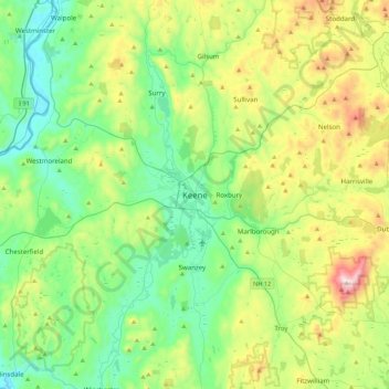
Name: Keene topographic map, elevation, terrain.

Location: Keene, Cheshire County, New Hampshire, 03435, United States (42.77360 -72.43843 43.09360 -72.11843)

Average elevation: 314 m

Minimum elevation: 59 m

Maximum elevation: 949 m

Gear up for your next adventure:

🧢Hiking Hat - Sun-protective and breathable hats for long treks
🛏️Camping Sleeping Mat - Comfortable mats for sleeping outdoors
🥾All-Terrain Hiking Boots - Versatile boots for varied hiking conditions
🩹Compact First Aid Kit - Pre-packed essentials for common trail injuries
🥾Trail Hiking Socks - Comfortable socks to prevent blisters and fatigue

As an Amazon Associate, this site earns from qualifying purchases at no extra cost to you.