Geolocate

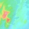
Dajav topographic map

Click on the map to display elevation.

About this map

Name: Dajav topographic map, elevation, terrain.

Location: Dajav, Jodhpur Tehsil, Jodhpur, Rajasthan, India (26.39144 73.04580 26.43144 73.08580)

Average elevation: 246 m

Minimum elevation: 229 m

Maximum elevation: 317 m

Other topographic maps

Click on a map to view its topography, its elevation and its terrain.
Jodhpur

India > Rajasthan > Jodhpur Tehsil

Average elevation: 238 m

Kayalana Lake

India > Rajasthan > Jodhpur Tehsil

Average elevation: 288 m

Ranisar Talab

India > Rajasthan > Jodhpur Tehsil > Jodhpur

Average elevation: 282 m

Jodhpur

India > Rajasthan > Jodhpur Tehsil

Average elevation: 238 m

Jodhpur

India > Rajasthan > Jodhpur Tehsil

Average elevation: 238 m

Gear up for your next adventure:

🧼Biodegradable Camp Soap - Environmentally friendly cleaning for gear and body
🧢Hiking Hat - Sun-protective and breathable hats for long treks
🔋Solar Power Bank - Keep your GPS and devices charged during long outdoor trips
🔋Lithium AA Batteries - Long-lasting power that performs in extreme cold
🥾Waterproof Hiking Boots - Boots keeping your feet dry in wet conditions

As an Amazon Associate, this site earns from qualifying purchases at no extra cost to you.