Geolocate

Pontypridd topographic map

Click on the map to display elevation.

About this map
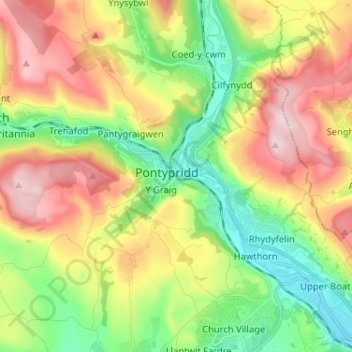
Name: Pontypridd topographic map, elevation, terrain.

Location: Pontypridd, Rhondda Cynon Taf, Wales, CF37 1LE, United Kingdom (51.56010 -3.38494 51.64010 -3.30494)

Average elevation: 184 m

Minimum elevation: 37 m

Maximum elevation: 380 m

Gear up for your next adventure:

⛺Bushcraft Tarp - Versatile emergency shelter or gear protection
🥾Trail Hiking Boots - Supportive boots for rough trails
🥾Trail Running Shoes - Lightweight and durable shoes for trail running
🛶Waterproof Dry Bags - Keep electronics and clothes dry during river crossings
💡LED Headlamp - Hands-free illumination for night hiking and camping

As an Amazon Associate, this site earns from qualifying purchases at no extra cost to you.