Geolocate

Mendenhall topographic map

Click on the map to display elevation.

About this map

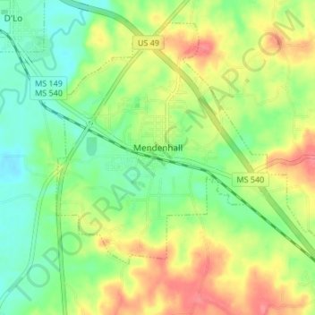
Name: Mendenhall topographic map, elevation, terrain.

Location: Mendenhall, Simpson County, Mississippi, United States (31.93579 -89.89444 31.98486 -89.82709)

Average elevation: 109 m

Minimum elevation: 78 m

Maximum elevation: 151 m

Other topographic maps

Click on a map to view its topography, its elevation and its terrain.

Pinola

United States > Mississippi > Simpson County

Average elevation: 96 m

Sanatorium

United States > Mississippi > Simpson County

Average elevation: 147 m

Gear up for your next adventure:

🛶Kayak Accessories - Essential gear for safe and fun kayaking adventures
🥾Trail Running Shoes - Lightweight and durable shoes for trail running
📷Outdoor Action Camera - Capture high-elevation views and rugged adventures
🌡️Emergency Mylar Blankets - Compact thermal protection for unexpected nights outdoors
🥘Camping Cookware Set - Compact nesting pots and pans for trail cooking

As an Amazon Associate, this site earns from qualifying purchases at no extra cost to you.