Geolocate

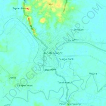
Tanah Grogot topographic map

Click on the map to display elevation.

Tanah Grogot

Tanah Grogot is located on the southern part of Paser Regency, eastern side of Borneo. Its average elevation is 5 meters above the sea level.

Wikipedia (CC-BY-SA 3.0)

About this map

Name: Tanah Grogot topographic map, elevation, terrain.

Location: Tanah Grogot, Paser, East Kalimantan, 76271, Indonesia (-2.07389 116.03803 -1.75389 116.35803)

Average elevation: 15 m

Minimum elevation: -4 m

Maximum elevation: 297 m

Other topographic maps

Click on a map to view its topography, its elevation and its terrain.

Sungai Kendilo

Indonesia > East Kalimantan > Paser > Pepara

Average elevation: 5 m

Gear up for your next adventure:

⛺Camping Tent - Weather-resistant tents suitable for 2 to 6 people
🥾Trail Hiking Boots - Supportive boots for rough trails
🧴Waterproofing Spray - Restore the DWR coating on jackets and tents
🥤Collapsible Travel Cup - Saves space and weight in your mess kit
☕Camping Coffee Maker - Brew fresh coffee anywhere on the topographic map

As an Amazon Associate, this site earns from qualifying purchases at no extra cost to you.